
When engaging a utility locating provider, one of the most common misunderstandings is the difference between a standard field report and a survey-grade subsurface utility deliverable.
While both outputs relate to identifying underground services, they serve very different purposes. At a glance, they may appear similar – both showing where services are located – but the way the data is captured, processed, and ultimately used is fundamentally different. This distinction has a direct impact on accuracy, usability, and project risk.
The Standard PDF ‘Field Report’
A field report is best understood as a record of site findings, prepared by a utility locator following an investigation. It captures what has been identified on the day and communicates that information in a clear, practical format.
Typically, a field report will include:
- Marked-up photos and site sketches
- Annotated plans or diagrams
- Service types (power, water, telecom, etc.)
- Approximate depths (where achievable)
- Locator notes and observations
This format is intentionally streamlined. It allows for fast turnaround and provides clients with immediate visibility of underground services, making it highly effective for early-stage decision-making.
From a usability perspective, field reports are well suited to:
- Preliminary investigations
- Health and safety planning
- General service awareness prior to minor works
However, it is important to recognise their limitations. A field report is not a spatially controlled dataset. The information is not tied to a survey coordinate system, meaning positions are relative rather than absolute. While the interpretations are informed and professional, the output is not intended for detailed design or construction set-out.
The ‘Survey-Grade’ Deliverable
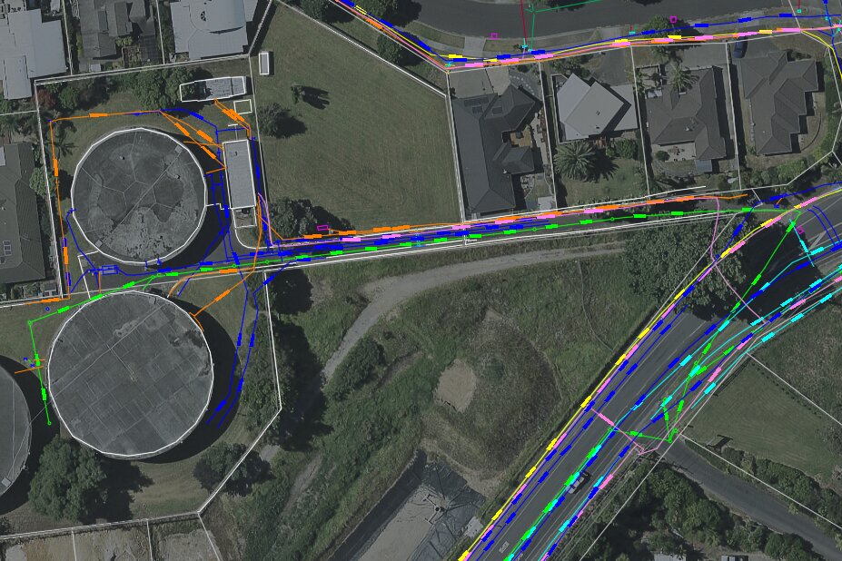
A survey-grade deliverable represents a fully integrated, spatially accurate dataset, combining utility locating with professional surveying.
At Ground Scan NZ, these deliverables are aligned with standards such as LINZ OP S 01287, ensuring consistency, traceability, and defined accuracy classifications.
Unlike a field report, this is not simply a record of observations – it is a design-ready output that can be directly integrated into engineering and asset management workflows.
A survey-grade deliverable typically includes:
- Utilities captured with precise X, Y, Z coordinates
- Integration with topographic survey data
- CAD and/or GIS files suitable for design
- Layered, structured digital outputs
- Accuracy statements and supporting metadata
This enables the data to be used with confidence across a range of applications, including:
- Engineering design and modelling
- Clash detection and coordination
- Construction planning and set-out
- Long-term asset management and GIS systems
Accuracy: The Critical Distinction
The most important difference between the two deliverables lies in accuracy and spatial reliability.
A field report provides an informed interpretation of what is present on site.
A survey-grade deliverable defines exactly where those services are, within known tolerances.
In practical terms:
- Field Report
- Relative positioning
- No formal accuracy classification
- Not survey-referenced
- Survey-Grade Deliverable
- Survey-controlled positioning
- Coordinates tied to real-world systems
- Delivered with defined accuracy standards
This distinction becomes critical once a project moves beyond investigation and into design or construction.
Usability Across the Project Lifecycle
Different stages of a project demand different levels of certainty. Choosing the appropriate deliverable is about aligning with the level of risk and decision-making required.
- Early-stage / feasibility
Field reports are often sufficient to inform initial planning and identify constraints. - Detailed design
Survey-grade deliverables become essential, allowing designers to work with confidence and avoid clashes. - Construction and delivery
Accurate, survey-referenced data is critical to prevent service strikes, delays, and rework. - Asset management
Only survey-grade data can be reliably integrated into GIS and long-term records.
Cost vs Value
It is natural to focus on the cost difference between the two outputs, but it is important to understand what drives that difference.
Field reports are more cost-effective because they primarily reflect site time, with minimal post-processing. Survey-grade deliverables, on the other hand, involve a broader and more rigorous workflow, including survey control, data integration, processing, validation, and structured digital output.
Survey-grade deliverables typically involve:
- Establishment of survey control
- Integration of multiple datasets (EML, GPR, topographic survey)
- Data processing, QA, and validation
- CAD/GIS drafting and structured outputs
- Professional accountability aligned with recognised standards
While the upfront cost is higher, the value becomes clear when considered in the context of the overall project. Accurate data reduces uncertainty, enables better design decisions, and significantly lowers the risk of costly errors during construction.
Making the Right Choice
A simple way to think about it:
- Use a field report when you need awareness
- Use a survey-grade deliverable when you need certainty
If your project involves design, excavation in complex environments, or coordination between multiple disciplines, survey-grade data is not just beneficial – it is essential.
The Ground Scan NZ Approach
At Ground Scan NZ, we provide both levels of service and, importantly, help our clients select the right approach for their specific project.
By combining advanced utility locating technologies with our in-house survey capability, we deliver:
- Seamless transition from field investigation to design-ready outputs
- Consistent, integrated datasets
- Faster turnaround times
- Greater accountability across all deliverables
Final Thoughts
Field reports and survey-grade deliverables each play an important role, but they are not interchangeable. Understanding when to use each – and aligning that decision with your project requirements – is critical to achieving a safe, efficient, and successful outcome.
If you are unsure which approach is right for your project, we are always available to provide guidance. Getting this decision right early can save significant time, cost, and risk down the line.
