
Ground Penetrating Radar (GPR) has become one of the most powerful and widely used technologies for non-invasive subsurface investigation. From utility locating and concrete scanning through to large-scale infrastructure and geophysical investigations, GPR plays a critical role in helping clients make informed decisions before any excavation or construction activity begins.
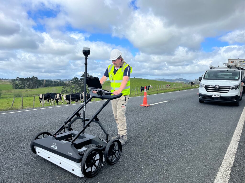
At Ground Scan NZ, we utilise both 2D and Multi-Channel (3D) GPR systems to deliver high-resolution insights into the subsurface environment. However, like any technology, GPR is not without its limitations. Understanding both its capabilities and constraints is essential to achieving reliable, defensible outcomes.
What is GPR?
Ground Penetrating Radar is a geophysical method that transmits high-frequency electromagnetic waves into the ground. These waves reflect off subsurface features such as buried utilities, voids, changes in material, or structural elements. The reflected signals are then captured and processed to create an image of what lies beneath the surface.
Unlike traditional excavation methods, GPR is:
- Non-destructive
- Rapid to deploy
- Highly versatile across multiple environments
Key Applications of GPR
1. Utility Locating and Mapping
GPR is widely used to detect both metallic and non-metallic underground services, including:
- Water mains
- Stormwater and wastewater pipes
- Power and communication cables
- Gas infrastructure
When combined with electromagnetic locating (EML) and survey-grade mapping, GPR forms a critical component of design-grade subsurface utility mapping, compliant with standards such as LINZ OP S 01287 Utility Survey Standard.
2. Concrete Scanning
GPR is highly effective for scanning concrete structures to identify:
- Reinforcing steel (re-bar)
- Post-tension cables
- Conduits and embedded services
This is essential for:
- Coring and drilling works
- Structural modifications
- Safety assurance prior to cutting
3. Subsurface Mapping (3D GPR)
Multi-Channel (3D) GPR enables large areas to be scanned quickly and accurately, producing detailed three-dimensional models of the subsurface.
Applications include:
- Road corridor investigations
- Infrastructure upgrades
- Brownfield development sites
- High-density utility environments
At Ground Scan NZ, these datasets are processed in-house and integrated into CAD and GIS platforms, allowing clients to visualise the subsurface with clarity and confidence.
4. Void Detection and Ground Condition Assessment
GPR can identify:
- Subsurface voids
- Loss of ground support
- Anomalies beneath pavements or slabs
This is particularly valuable for:
- Asset management
- Pre-construction risk mitigation
- Failure investigations
5. Specialist Investigations
Advanced GPR applications extend into more complex environments, including:
- Indoor scanning within operational facilities
- Protected tree root mapping
- Historic and culturally sensitive site investigations
- Forensic and investigative work
Limitations of GPR
While GPR is a powerful tool, it is not a “silver bullet.” Its performance is influenced by a range of environmental and site-specific factors.
1. Ground Conditions
GPR performance is highly dependent on soil type.
- Highly conductive soils (e.g. clay, saturated ground) can significantly reduce signal penetration
- Dry, sandy soils typically provide the best results
In some conditions, depth penetration may be limited to less than one meter.
2. Depth vs Resolution Trade-off
There is a fundamental trade-off between depth and clarity:
- Higher frequency = better resolution, shallower depth
- Lower frequency = greater depth, reduced detail
Selecting the correct antenna and methodology is critical.
3. Interpretation Complexity
GPR does not produce a simple “image” like an X-ray.
- Data requires specialist processing and interpretation
- Results can be influenced by:
- Ground conditions
- Target material
- Surrounding interference
This is where experience matters – data capture alone is only part of the process.
4. Non-Uniqueness of Results
Not all anomalies can be definitively identified.
For example:
- A pipe, void, or change in material may produce similar signal responses
- Additional methods (EML, hydro-excavation, CCTV) are often required for confirmation
5. Reinforced or Congested Environments
In areas with:
- Multiple layers of reinforcement
- Dense utility networks
Signal clutter can make interpretation more challenging.
The Importance of an Integrated Approach
The most reliable outcomes are achieved when GPR is not used in isolation.
At Ground Scan NZ, we combine:
- Electromagnetic locating (EML)
- 2D and 3D GPR
- Survey-grade mapping
- Hydro-excavation verification
This end-to-end, in-house approach ensures:
- Greater accuracy
- Faster turnaround
- Clear accountability
Conclusion
Ground Penetrating Radar is an incredibly versatile and powerful technology that provides valuable insight into the subsurface without the need for excavation. However, its effectiveness depends heavily on how it is applied, interpreted, and integrated with other methodologies.
Understanding both the applications and limitations of GPR allows clients to make informed decisions, reduce risk, and avoid costly surprises during construction.
At Ground Scan NZ, we don’t just collect data – we analyse, interpret, and deliver clear, defensible outputs that our clients can rely on with confidence.
Talk to the Experts
If you’re planning works that involve excavation, drilling, or subsurface risk, get in touch with Ground Scan NZ to discuss how our GPR and utility mapping services can support your project.
