
Identifying underground utilities before breaking ground is a critical step in any construction project. Accurate utility information supports designers and engineers during the planning phase and provides contractors with the confidence to work safely and efficiently during construction.
Traditionally, located utilities are marked directly on the ground with a chalk-based paint. While these markings indicate the location, depth, and type of service, they are temporary and limited in use. Some Utility Locators may also provide a basic PDF ‘mark-up’ with coloured lines overlaying the markings on the ground —but how accurate is this information? What scale has it been drawn to? Can it be reliably used for design and construction?
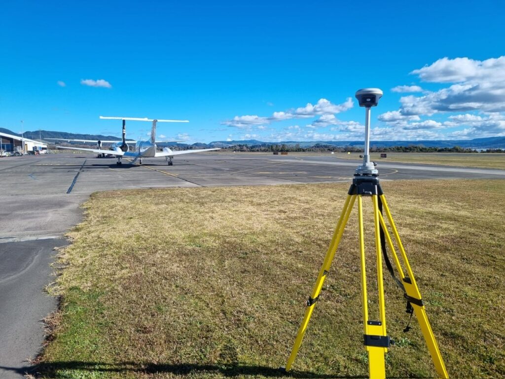
 At Ground Scan NZ, we take Utility Locating a step further by combining it with professional surveying. Unlike some locators using app-based mapping tools and low-grade GPS equipment with undefined coordinate systems, our in-house survey team ensures your data is precise, reliable, and ready for integration into your project.
Our Survey Manager brings over a decade of construction surveying expertise, supported by the latest-generation RTK GPS technology. Using GPS base and rover methods, we capture high-accuracy data, process it in Civil 3D, and deliver it in clear, scalable formats. Clients receive:
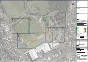
- Accurate PDF plan sets with scaled, easy-to-read layouts
- CAD linework (DWG or preferred formats) for direct use in design and engineering workflows
- Asset data ownership – the information we provide is yours to use, share, and build upon for future projects
Ground Scan NZ can also as-built any additional works and integrate them into existing records, ensuring your utility data remains complete and up to date.
Ready to streamline your project with reliable survey-quality utility data?
Contact Ground Scan NZ today to see how we can add value to your next project.
