
When planning construction, infrastructure upgrades, or site investigations, having a clear understanding of what lies beneath the surface is critical. Ground Scan NZ offers advanced 3D multichannel Ground Penetrating Radar (GPR) services, providing clients with high-resolution, reliable subsurface data that goes far beyond traditional 2D surveys.
So, what exactly is 3D multichannel GPR, and how does it work? Ground Penetrating Radar is a geophysical method that uses radar pulses to image the subsurface. Unlike conventional 2D GPR, which collects data along single lines and produces a series of one-dimensional slices, 3D multichannel GPR gathers multiple parallel radar traces simultaneously across a wide area. This allows us to create dense, three-dimensional datasets that represent the underground environment in much greater detail.
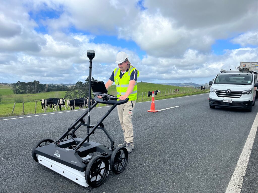
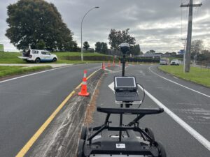
At Ground Scan NZ, we use the IDS Geo Radar Stream DP unit, one of the most advanced 3D multichannel GPR systems available. This technology collects data at multiple depths and across broad survey corridors, producing highly accurate volumetric images of the subsurface. Once collected, the data is processed using IQ Maps software, enabling our team to visualise, analyse, and interpret complex underground features with precision.
The benefits of 3D multichannel GPR over traditional 2D surveys are significant. With 2D GPR, survey lines are spaced apart, which can leave gaps in coverage and risk missing critical utilities or features. In contrast, 3D multichannel surveys provide continuous coverage, reducing the chance of missing buried services and giving clients a more complete and reliable view of the subsurface. This is particularly important for complex sites with multiple overlapping utilities, large open areas, or locations where accurate mapping is essential for design and construction planning.
Another key advantage is the efficiency of 3D multichannel GPR. By collecting multiple parallel profiles in a single pass, surveys can be completed more quickly while still capturing far more data than conventional 2D methods. Combined with professional data processing and interpretation, this allows Ground Scan NZ to deliver precise outputs in CAD DWG and PDF formats that clients can confidently use for project planning, risk management, and compliance.
Ground Scan NZ is proud to be the only company in the Waikato region offering this level of 3D multichannel GPR capability. Our investment in advanced technology, combined with expert interpretation and surveying skills, ensures that clients receive the most accurate and actionable subsurface data available.
Whether you’re planning roadworks, building developments, or large-scale infrastructure projects, 3D multichannel GPR provides the clarity and confidence needed to proceed safely and efficiently. By choosing Ground Scan NZ, you’re choosing a partner who can deliver unmatched accuracy and insight beneath the surface.
